On 22nd August Saturday morning at
7:00 AM we started our journey from Pune to Ekole base village of Ghangad fort.
We were heading towards Ghangad fort through Tamhini Ghat route. One of our
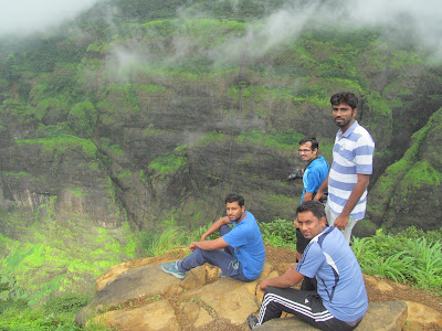
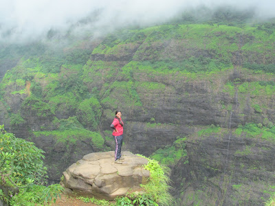
lead Sai Upalekar knows about the Independence Point near Andharban Trail Start
point, so we requested to have look of that point. That was the awesome view of
valley which is more than 2000 feet deep. After having some clicks there we
started again & at around 8:30 AM, we reached the Ekole base village of
Ghangad fort.
 |
| Photo Credit :Aniket Bidkar |
 |
| Clicked By :RC |
 |
| Clicked By :RC |
 |
| Clicked By :RC |
 |
| Clicked By :RC |
 |
| Clicked By :RC |
 |
| Clicked By :RC |
 |
| Clicked By :RC |
There
is not much documentation explored about history of the Ghangad fort. Earlier it was ruled
by Koli Samant, then with Adilshah and later the Marathas.
 |
| Clicked By :RC |
Actually this fort is very small. Ghangad
is situated on western side of Mulshi River, which is called as Korbarase
Maval. One can reach the fort by a path from left of the fort. As you enter
from the devastated structure of big entrance, you can see some remnants of old
palaces along with some water cisterns which are now in very bad
condition. You can see Sudhagad, Sarasgad and wall of Tailbaila from the fort,
also Nandand Ghat, Savvashincha Ghat and Bhorpaychi Nal, which descend to
Konkan. At the entrance of fort initially you will go through two pillars,
almost at the end of existence.
 |
| Clicked By :RC |
 |
| Clicked By :RC |
 |
| Clicked By :RC |
 |
| Clicked By :RC |
 |
| Clicked By :RC |
 |
| Clicked By :RC |
 |
| Clicked By :RC |
 |
| Clicked By :RC |
 |
| Clicked By :RC |
 |
| Clicked By :RC |
 |
| Clicked By :RC |
 |
| Clicked By :RC |
At one
point on the trek route there is hanuman temple. After entering in fort through
those pillars we saw few caves. After seen those caves we went to explore right
side of fort, there we saw tunnel formed by biggest rock fall on the fort
ground. There we saw the Goddess Garjai temple in cave which is in very
bad condition. From there with the help of rope already present there I only
went ahead to see the cave having SHILA
LEKH is very hard to access, need to walk along with the rock, by taking
help of rope already present there, but very risky because one wrong step or misbalance
will cost your life.
 |
| Clicked By :RC |
 |
| Clicked By :RC |
 |
| Clicked By :RC |
 |
| Clicked By :RC |
 |
| Clicked By :RC |
 |
| Clicked By :RC |
 |
| Clicked By :RC |
 |
| Clicked By :RC |
 |
| Clicked By :RC |
After that we went to explore left side of
entrance, where one ladder is placed to go upside on fort, there we saw few
water cisterns full of water & it was rainy season few steps after ladder
are very slippery and dangerous, with the help of rope we crossed those steps
as well and reached on top of fort. Another biggest pillar on fort was there,
we had some clicks there & had site seen of forest around & beautiful
waterfalls.
 |
| Clicked By :RC |
 |
| Clicked By :RC |
 |
| Clicked By :RC |
 |
| Clicked By :RC |
 |
| Clicked By :RC |
 |
| Clicked By :RC |
 |
| Clicked By :RC |
 |
| Clicked By :RC |
 |
| Clicked By :RC |
 |
| Clicked By :RC |
 |
| Clicked By :RC |
 |
| Clicked By :RC |
 |
| Clicked By :RC |
 |
| Clicked By :RC |
 |
| Photo Credit : Prashant Gupta |
 |
| Photo Credit : Prashant Gupta |
After exploring full fort we started
descending & reached Ekole village at 1:00 PM, there we had lunch at
village temple. Suddenly our leaders Kishor Wagh, Sai Upalekar & me decided
to go at Tailbaila Wall base point, which is 8.3Km from Ekole village.
 |
| Clicked By :RC |
 |
| Clicked By :RC |
We reached Tailbaila village at 3:00 PM &
without wasting much time we started our trek to Tailbaila wall base. Initially
we crossed few farms then entered into forest & within an hour we reached
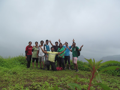
the base point of wall. During the walk we had some group pictures &
clicked wall pictures in different angles. Talking about Tailbaila is a
magnanimous monolith, which resembles a cobra head. Located at a distance of
about 94km from Pune, it is a bastion that is perfect for climbing enthusiasts
and adventure seekers. The summit offers majestic views of the Konkan Valley
which make all the effort seem worthwhile. After taking rest at base
point temple & few views of surrounding, we started descending &
reached base village at 6:00 PM & started back journey to Pune. During back
journey we had crazy dance in bus & had tea break at food plaza on high
way.
 |
| Clicked By :RC |
 |
| Clicked By :RC |
 |
| Clicked By :RC |
 |
| Clicked By :RC |
 |
| Clicked By :RC |
 |
| Clicked By :RC |
 |
| Clicked By :RC |
 |
| Clicked By :RC |
 |
| Clicked By :RC |
 |
| Clicked By :RC |
 |
| Clicked By :RC |
 |
| Clicked By :RC |
 |
| Clicked By :RC |
 |
| Clicked By :RC |
 |
| Clicked By :RC |
 |
| Clicked By :RC |
In this way we completed one more trek at
9:00 PM on 22nd August 2015 & entered in our regular concrete
forest with so many awesome memories & photographs with us.
Approximate Distance from Pune
Approx. 90 Kms [ Pune- Pirangut - Mulshi
- Tamhini - Bhamburde- Ekole(Base village) ]
Distance will increase via Lonavala
Note:
- Photo Credit goes to Rahul Chandure, Aniket Bidkar & Prashant Gupta.
- Such an amazing fort everyone should visit at least once in life.
- Before going on trek do some research what to explore there.
Please leave
comments below for others if you have been to Independence Point, Ghangad &
Tailbaila fort wall base point or you have any questions related to trek.
Enjoy!!!!
Thanks & Regards
Rahul Chandure




That was nice trek. Thanks for nice arrangement. Awesome Photos.
ReplyDeletethank you so much bro :) ......
DeleteFort is nicely described and information is also useful. I liked the way you clicked the pictures of the fort and added neatly in the blog. Thanks for writing this blog.
ReplyDeleteHow to play Baccarat, the card game of baccarat
ReplyDeleteThe object of the 샌즈카지노 game of baccarat 바카라 is to be the highest possible 바카라 사이트 score on the card game board. All six players take turns scoring on